

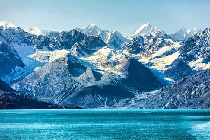
When high mountain ice fails, it doesn’t simply melt—it detonates the landscape. The Nepal–Tibet disaster was such a detonation: a glacier collapse that converted thousands of feet of vertical fall into a rushing mass of water, rock, and mud that erased roads, hydropower sites, border facilities, and entire settlements downstream. The scale of devastation is matched by the scale of the response now underway.
At a Glance
- A catastrophic glacier collapse triggered a flash flood and debris flow along the Nepal–Tibet border, killing hundreds and leaving more than a thousand missing.
- Nepal’s authorities have mobilized over 13,000 security personnel and 15 helicopters, alongside emergency coordination teams for search, relief, and recovery.
- USGS and multiple scientific teams attribute the disaster to a glacial collapse whose impact registered as a magnitude ~5.2 seismic signal, not an earthquake causing the collapse.
- The event fits a broader Himalayan pattern of warming-driven ice and debris instability, complicating disaster labeling and emergency planning.
What Happened: A Glacier Collapse Became a Valley-Filling Torrent
By mid-morning, a section of high Himalayan glacier failed catastrophically, plummeting down to the valley floor and transforming into a high-energy debris flow. The physics are unforgiving: ice and rock accelerate over thousands of vertical feet, entraining water, soil, and boulders until the flow behaves like a slurry that can climb valley walls and pulverize infrastructure. Scientists and the United States Geological Survey converged on a clear explanation—this was a glacial collapse and ensuing debris flow whose impact registered as seismic energy around magnitude 5.2; the tremor was an effect of the collapse, not its cause. Early casualty counts rapidly climbed into the hundreds, with missing persons figures surpassing a thousand across Nepal and Tibet as rescuers battled remoteness, damaged roads, and unstable slopes.
The mechanism matters. A glacial collapse differs from a glacial lake outburst flood (GLOF): the former originates from the structural failure of ice and rock; the latter from the sudden breach of a lake impounded by ice or debris. On the ground, both deliver valley-scale devastation, but they imply different monitoring, early warning, and land-use strategies. In this case, remote sensing and field accounts support the collapse-and-debris-flow sequence, not a lake breach.
Rescue, Relief, and Coordination: The Response System at Full Stretch
Nepal’s disaster command architecture surged into action with a mix of manpower, aviation, and interagency coordination. The National Disaster Risk Reduction and Management Authority (NDRRMA) reported the mobilization of 13,295 security personnel and 15 helicopters, alongside dedicated teams for search and rescue, health services, road clearance, relief distribution, and information management. This is how complex mountain response works when it works well: security forces push up valleys to reopen access and secure hazard zones; rotorcraft shuttle reconnaissance teams, medevac patients, and deliver high-value supplies; medical posts triage crush injuries, hypothermia, and contaminated-wound infections that often follow debris floods; logistics units pre-position shelter, food, and water treatment for displaced families.
These operational choices reflect hard lessons from decades of Himalayan disasters. Air assets are rationed carefully—thin air at altitude reduces lift; pilots must thread unstable terrain, erratic weather, and dust or ash that can degrade turbine performance. Ground teams contend with scoured road benches, bridge washouts, and fresh landslides seeded by the initial shock. Information cells integrate satellite imagery, UAV reconnaissance, and field radio to prioritize searches where survival windows remain open and to plan relief drops to communities now cut off by gorges and broken highways.
Why Terminology Swings in the First 72 Hours—and Why It Matters
In the Himalaya, labels often arrive before the science. Early reports routinely oscillate among “earthquake,” “landslide,” “glacial collapse,” “mudslide,” and “GLOF,” because the processes are intertwined and field access is limited in the initial window. Here, initial statements referenced a quake; subsequently, USGS and multiple research teams showed the seismic signal was generated by the collapse itself, not a tectonic trigger. That correction is not pedantry. Distinguishing a collapse-driven debris flow from a lake breach guides the next steps: which valleys to monitor for secondary surges, what remote-sensing targets to prioritize, and which infrastructure types—bridges versus dams versus power intakes—remain at greatest residual risk.
Risk managers also read these labels as policy. A confirmed glacial collapse, in the context of regional warming, points to slope and permafrost instability and the need for cryosphere-aware engineering and land-use buffers; a GLOF diagnosis would shift emphasis to lake monitoring, moraine-dam stability, and controlled outlet works. In either case, communities downstream of steep, icy headwaters face rising volatility as warming dismantles the “cryosphere glue” that binds rock, ice, and debris at altitude.
The Human Toll and the Geography of Exposure
The numbers convey both scale and uncertainty: hundreds confirmed dead and well over a thousand missing across the Nepal–Tibet corridor, with losses spread across border towns, hydropower sites, customs infrastructure, and tourist routes. Exposure is structural, not incidental. Steep tributaries concentrate settlements at valley confluences and transport nodes; hydropower projects, by design, nestle in narrow gorges to capture head and flow. When a collapse entrains enough water and debris, those same choke points magnify impacts, sweeping away intake structures, penstocks, switchyards, and roads in a single surge. Satellite imagery and on-the-ground video depict a classic pattern: stripped floodplains, channel avulsions, and “rafted” building slabs stranded far from original foundations.
Hospitals downstream face classic surge challenges—trauma care under intermittent power, disrupted supply chains, and a patient mix that shifts from acute injuries to waterborne disease over days. Socially, missing-persons networks stretch across borders, with rescuers parsing manifests from pilgrims, trekkers, and transport convoys to focus searches where last known locations cluster.
What Science and Engineering Can Do Next
Three domains define the path forward. First, detection: repeat satellite passes, InSAR deformation data, and automated change detection can flag fresh scarps and ice cliffs primed to fail. Second, warning: simple, robust river gauges and acoustic flow monitors in headwater canyons—backed by satellite uplinks—can buy tens of minutes for downstream alerts. Third, design: hydropower and transport corridors need debris-flow compatible siting and armoring, including sacrificial berms, elevated control rooms, breakaway spans, and bypass channels engineered to vent extraordinary flows without catastrophic backwater effects. None of this is speculative; it is established practice in other debris-flow-prone mountain belts, now urgently applicable here.
Policy must then connect these technical capacities to governance. The NDRRMA’s coordination role can institutionalize post-event forensics—standardized event inventories, transparent release of high-resolution imagery, and open hazard maps—to guide reconstruction that does not simply replace assets in the same impact corridors. Cross-border data sharing matters too; headwaters and communities do not observe administrative lines, and the physics of runout are indifferent to customs posts.
A desperate search is underway for more than 1,500 people still missing after catastrophic flooding devastates Nepal and Tibet.
At least 547 people are dead, with about 90 Americans among those still unaccounted for.
The disaster was reportedly triggered by a glacier collapse… pic.twitter.com/wvMrAYpfo8
— Christopher Raia (@JohnSmith5baf) August 28, 2026
The Hard Truth of a Warming, Unstable High Asia
The Himalaya is a young, rapidly uplifting mountain system coated in ice that is thinning, fracturing, and warming. That combination raises baseline hazard even when monsoon rains are ordinary and seismicity is quiet. The Nepal–Tibet collapse illustrates a modern reality: extreme-energy events can originate without a storm or a tectonic jolt, yet still deliver flood magnitudes comparable to dam-break scenarios. For communities, planners, and financiers, that means treating cryosphere failure as a design basis event, not a tail risk. For responders, it underscores why Nepal’s rapid multi-agency mobilization—thousands of personnel, rotary-wing lift, and mission-specific cells—is not extraordinary, but essential to keep the survivable survivable and the recoverable recoverable.
Sources:
facebook.com, bbc.com, aljazeera.com, english.khabarhub.com