

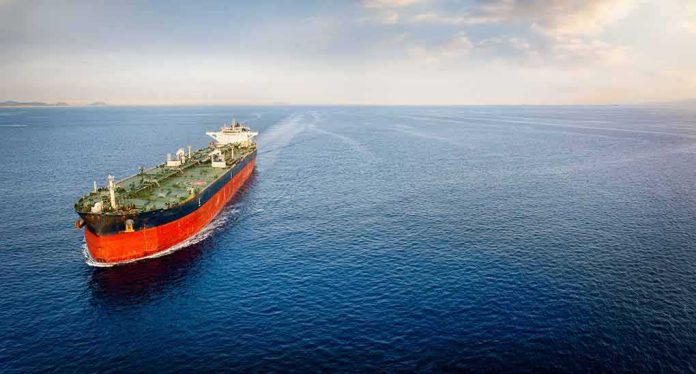
In chokepoints like Hormuz, navigation is policy: a “temporary corridor” is not just a set of GPS waypoints but a deconfliction instrument that can restart stalled trade, cool a hot front of a regional conflict, and shift bargaining power among states that live by seaborne energy flows.
At a Glance
- Oman says it is coordinating with the International Maritime Organization (IMO) on a temporary maritime corridor through the Strait of Hormuz to improve safe passage.
- Tehran and Muscat have publicly acknowledged negotiations focused on a time-bound, jointly agreed route and coordinates.
- The measure fits a decades-long pattern: Hormuz traffic already follows an IMO traffic separation scheme; temporary corridors are targeted overlays, not a reinvention.
- Because roughly a fifth to a quarter of globally traded oil moves through Hormuz, even short-lived routing changes can move markets and recalibrate regional leverage.
What Oman is proposing and why it matters
Oman’s foreign ministry has stated it is working “in coordination with the International Maritime Organization” to provide a temporary corridor option for all vessels transiting the Strait of Hormuz, with coordinates to be jointly published by Muscat and the IMO. This is not a toll road; the Omani statement explicitly ties the effort to freedom of navigation and international law, with no transit fees contemplated. In practical terms, a temporary corridor is a defined routing lane with promulgated coordinates, associated advisories, and, often, synchronized guidance among coastal authorities and pilotage centers—an overlay meant to reduce collision risk, route ships away from hazards such as mines, and lower the chance of escalation when navies and militias operate in proximity. The policy significance is larger than the geometry: when two riparian states agree on a corridor, they are also agreeing on where not to contest each ship, each day.
Iranian officials have described talks with Oman as focused on a temporary safe-shipping route, with public signaling that the arrangement would be finite and subject to a joint announcement. Statements from Tehran have included references to agreed or near-agreed coordinates and a final-drafting phase for a joint communiqué—diplomatic code for “the map is largely baked; the politics are catching up.” This is the scaffolding from which Oman’s hope to announce the corridor “soon” plausibly hangs.
How a “temporary corridor” works in a place already governed by lanes
Hormuz is not open ocean improvisation; since 1968 an IMO-mandated traffic separation scheme (TSS) has channeled inbound and outbound traffic through two-mile-wide lanes separated by a two-mile buffer. Temporary corridors do not discard that architecture. Instead, they selectively re-route traffic relative to the TSS—north or south of the usual tracks, or through a consolidated two-way lane—when specific threats, hydrographic constraints, or political control lines make the standard geometry suboptimal. Think of it as shifting the zipper on a jacket when a tooth breaks: the jacket remains, but you move the stress line to keep it closed.
This is why Muscat’s coordination with the IMO is decisive. The IMO is the clearinghouse for notices that shipmasters, insurers, and navies treat as operational law. A corridor published through IMO mechanisms becomes charted guidance, enabling underwriters to model risk and crews to plan under the COLREGs (Convention on the International Regulations for Preventing Collisions at Sea). In practice, promulgation with clear coordinates, timing, and communications protocols reduces ambiguity—the oxygen of mishaps and miscalculation.
Why Hormuz magnifies small navigational changes
At its narrowest, the Strait is roughly 29 nautical miles wide, but the navigable channels are only about two miles each way. That pinch point concentrates risk: even modest re-routings change who surveils which ships, which assets can interdict, and how mines and maritime drones can be laid or avoided. This geography underwrites Hormuz’s strategic gravity; in normal times about a quarter of seaborne oil trade passes through, alongside liquefied natural gas shipments central to Asian markets. When traffic dips or detours, the effects propagate across tanker rates, refinery slates, and sovereign balance sheets.
In crisis periods, the Strait’s management becomes a barometer of leverage. Announcing coordinates is a diplomatic act; enforcing them at sea is a test of capacity and restraint. A time-bound corridor can therefore serve three roles at once: a safety measure for mariners, an economic stabilizer for consumers and producers, and a signaling device between militaries and ministries that prefer predictability over brinkmanship.
What the Oman–Iran track tells us
Public briefings from Tehran and Muscat describe a converging negotiation: temporary, coordinate-based, and aimed at restoring safer passage without imposing fees or declaring a sovereignty outcome by cartographic stealth. Reporting has pointed to an “understanding” on the geographic coordinates and a joint statement in final drafting, conditioned—at least in Iranian phrasing—on the absence of third-party interference. That last caveat is typical of narrow-deal diplomacy in contested theaters; it is less an invitation to collapse than a reminder that corridor management exists within a wider conflict system.
If and when published, expect the corridor to be time-limited (weeks to a handful of months), accompanied by harmonized advisories and contact points for ship reporting, and nested within existing TSS references on electronic charts. Expect, too, a choreography of compliance: coastal states cue their maritime security centers; navies deconflict patrol boxes; insurers revisit war-risk premiums; and ship operators recalibrate routing models for laden and ballast legs. The first 72 hours after promulgation often set the norm—if several convoys pass uneventfully, adoption becomes sticky.
Continuity, not rupture, with Hormuz’s management history
Temporary corridors are part of a well-known playbook. Hormuz has cycled through traffic adjustments during wars, mining campaigns, and seizure scares for half a century. The point is not to normalize danger, but to professionalize around it—standardize reporting lines, segregate high-risk waters, and convert contested discretion into published procedure. This is why the IMO’s TSS has endured: it turns a geography problem into a governance process. The Oman–Iran effort, as described, operates inside that lineage.
The stakes explain the urgency. Energy security briefs and industry analyses converge on the same arithmetic: Hormuz’s throughput is unmatched by overland alternatives. Saudi Arabia’s east–west line and the UAE’s Fujairah route help, but they cannot replicate Hormuz volumes in the near term. That reality gives extraordinary value to even incremental risk reduction in the Strait; shaving the probability of a single high-casualty incident or an insurer’s red line can free millions of barrels per day back into predictable circulation.
Iran and Oman agree on temporary maritime corridor in Strait of Hormuz
Iran and Oman have agreed to work on a temporary maritime corridor aimed at restoring the safe movement of ships through the Strait of Hormuz.
The understanding came during talks between the two countries’…
— PakistanPulse (@Pakpulse247) August 25, 2026
What to watch next: signals of operational credibility
Three indicators will tell you whether the corridor moves from communiqué to lived reality. First, the Notice to Mariners trail: publication of coordinates via IMO channels, mirrored by coastal authorities, is the on-switch; delays or dueling notices introduce friction. Second, insurer behavior: reductions in war-risk premia for corridor-compliant sailings are the market’s verdict on risk delta and enforcement confidence. Third, traffic composition: when mainstream, insured tankers and LNG carriers—not only shadow fleets or state-linked hulls—adopt the route, the corridor has achieved legitimacy.
Sources:
timesofindia.indiatimes.com, fm.gov.om, aljazeera.com, nytimes.com